Human Security Interactive Map
Search through over 22,000 data points of air raid strikes during the war in Yemen. See the impact of war on Yemeni civilians over a 6 year period.
Filter dates
Each circle color represents a different year from 2015 to 2020. Filter the years and months to compare the strikes over time.
Civilian Casualities
The size of the circles represents the amount of civilian casualties per strike. You can use the filter to find strikes based on the amount of civilian casualties.
Location and Target Areas
Filter through locations in Yemen or the target category of the air raid strike. Categories range from military sites to hospitals.
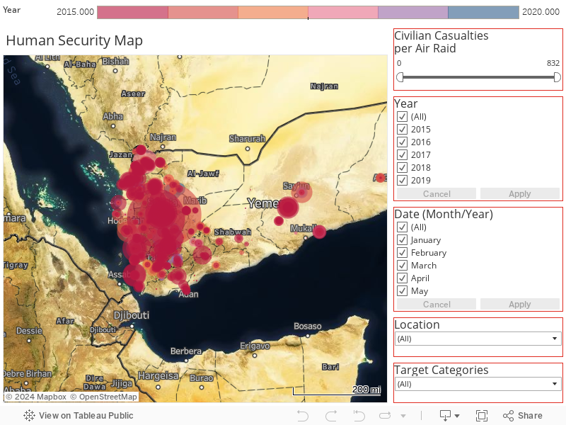
Map coordinates were collected by JMU research assistants. Some are approximate based on data provided.
Quick Facts
All data on air raids was collected by the Yemen Data Project. For updated statistics, please visit their website. The data set used ranges from March 2015 to December 2020.
Civilian Casualties
Total air raids displayed on Map
Air raids in a residential area
Reach Us
if you have any inquiries about The Yemen Human Security Project.
James Madison University, Harrisonburg, VA 22807
kausslbx@jmu.edu