Today, there has been a 99% decline in the oyster population. As such, only 1% remain. These little creatures are known as filter feeders, meaning they feed on plankton by opening their shells and pumping water through their gills. This action traps particles of food and gunk in the water, which essentially removes all sedimentation and negative particles from the water, thus filtering the Bay. The oyster could once filter a volume of water equal to that of the entire Bay (about 19 trillion gallons) in a week, improving water quality for other animals to live. However, because of their decline, it takes almost three years for the Bay to be completely filtered once.
To assist in solving this problem, Team Veliger’s ideal plan is to have a two drone system: an underwater drone (ROV) and an ariel drone (UVA). Both of these drones will be used to assist in the Chesapeake Bay’s oyster restoration efforts, and possibly, even oyster restoration efforts around the world. Although both drones will aid in oyster restoration research directly, the purpose of each drone is slightly different.
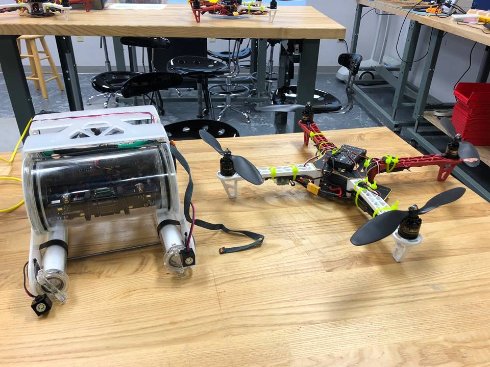
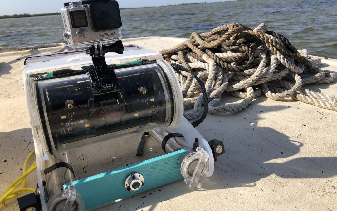
On the left, an ROV. On the right, a UAV.
Remote Operated Vehicle (ROV)
The underwater ROV will be used on submerged oyster reefs. This drone will be equipped with two additional propellers attached to the front, facing the oyster reefs. The purpose of the additional propellers is to work like an underwater leaf blower to remove excessive sediment covering existing oyster reefs. Although the process may sound simple, the solution is actually more complex.
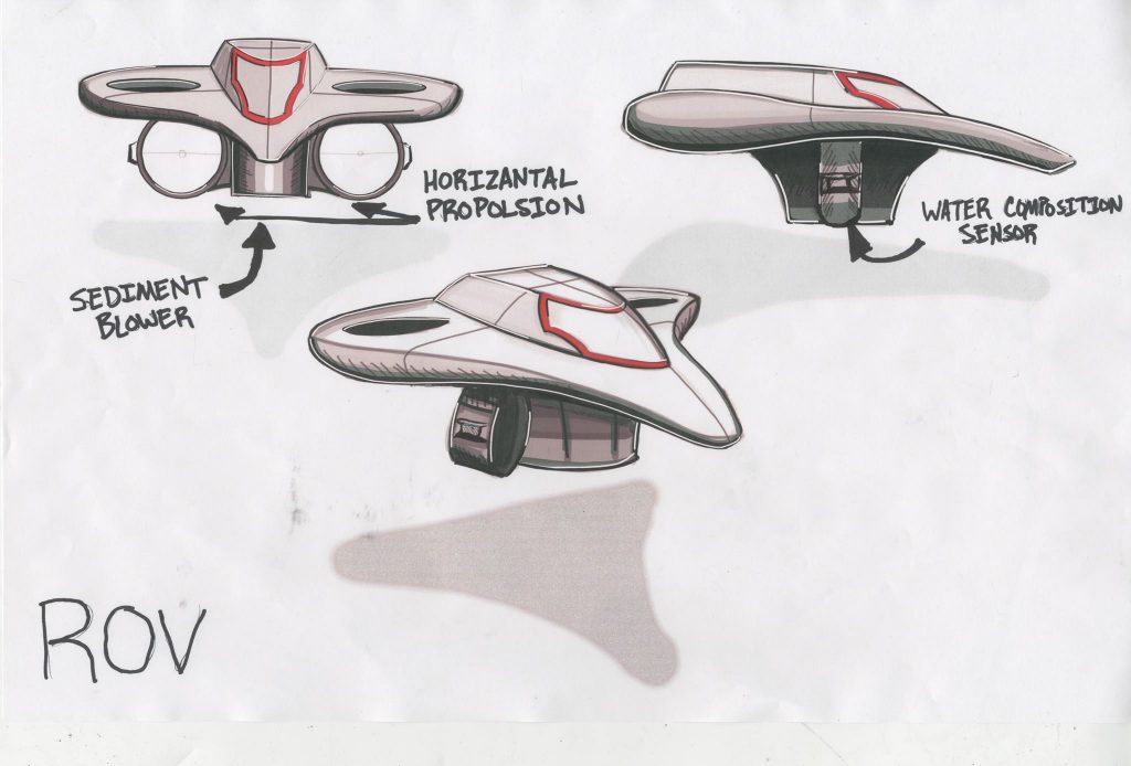
The ideal design of the underwater ROV created by Savio Duong.
Excessive amounts of solid sediments (SS) have begun entering the Bay through agricultural practices, land development, and simply from too many impervious services surrounding the Bay. As a result, oysters and other shellfish are now becoming suffocated by vast amounts of sediment covering their shells. Currently, there aren’t any ways to remove this excessive sediment from existing reefs unless they are located in oyster sanctuaries–areas where fishermen are not allowed to fish, harvest, or dredge. In these areas, scientists take it upon themselves to remove excessive sediment from the oysters, add recycled oyster shells, and monitor the reef to ensure its survival.
However, with the addition of our ROV, this would allow researchers to use a drone to remove excessive sediment on a routine basis, take water samples, and monitor the reefs from above instead of diving around the reefs, which are particularly sharp.
Unmanned Ariel Vehicle (UAV)
The UAV will be used to take high-quality images of intertidal oyster reefs in order to construct photogrammetry that can be used by researchers to determine oyster’s interstitial space and better understand the oyster’s physical structure. Thus, the drone will fly around the reef taking high-quality images using a Go Pro Hero 4 and ultimately use these images to construct a 3D model using software called Pix4D. With this information, researchers will have more information and details to better construct more natural looking artificial reefs that may, hopefully, allow for greater oyster growth and increased level of spat.
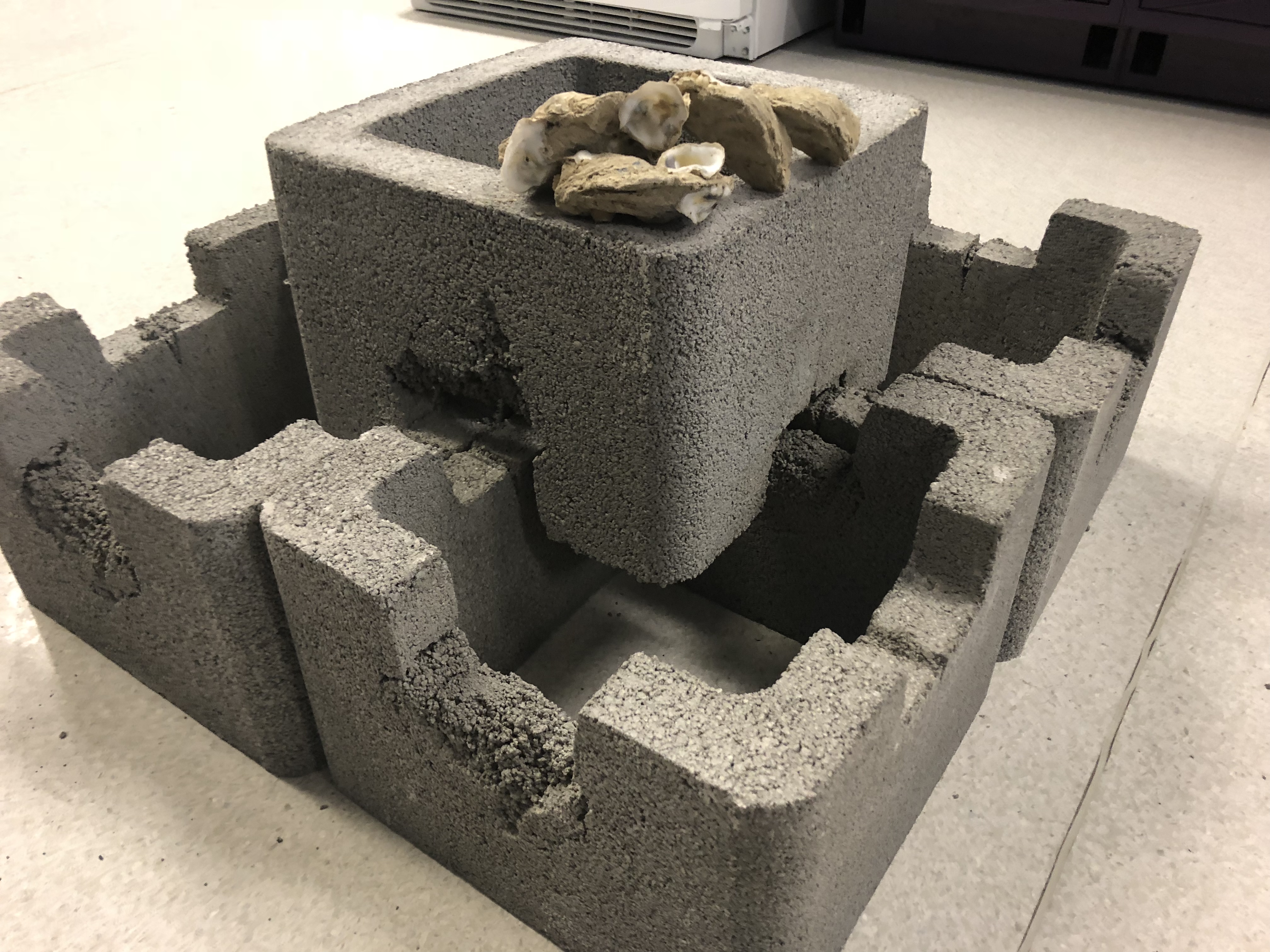
Current artificial oyster reefs.
The team decided to use a UAV for gathering images of oyster reefs instead of an ROV after the team discovered midway through their project that the high turbidity, or low visibility of the water, in the Bay would make it difficult to obtain high-quality images underwater. The was disappointing to the team at first since the Chesapeake Bay is almost exclusively filled with submerged oyster reefs; however, there are a small number of intertidal reefs, reefs that become exposed when there is low tide, and oyster reefs around the U.S. have more intertidal reefs than the Bay, so these images will be useful on a larger scale as well.
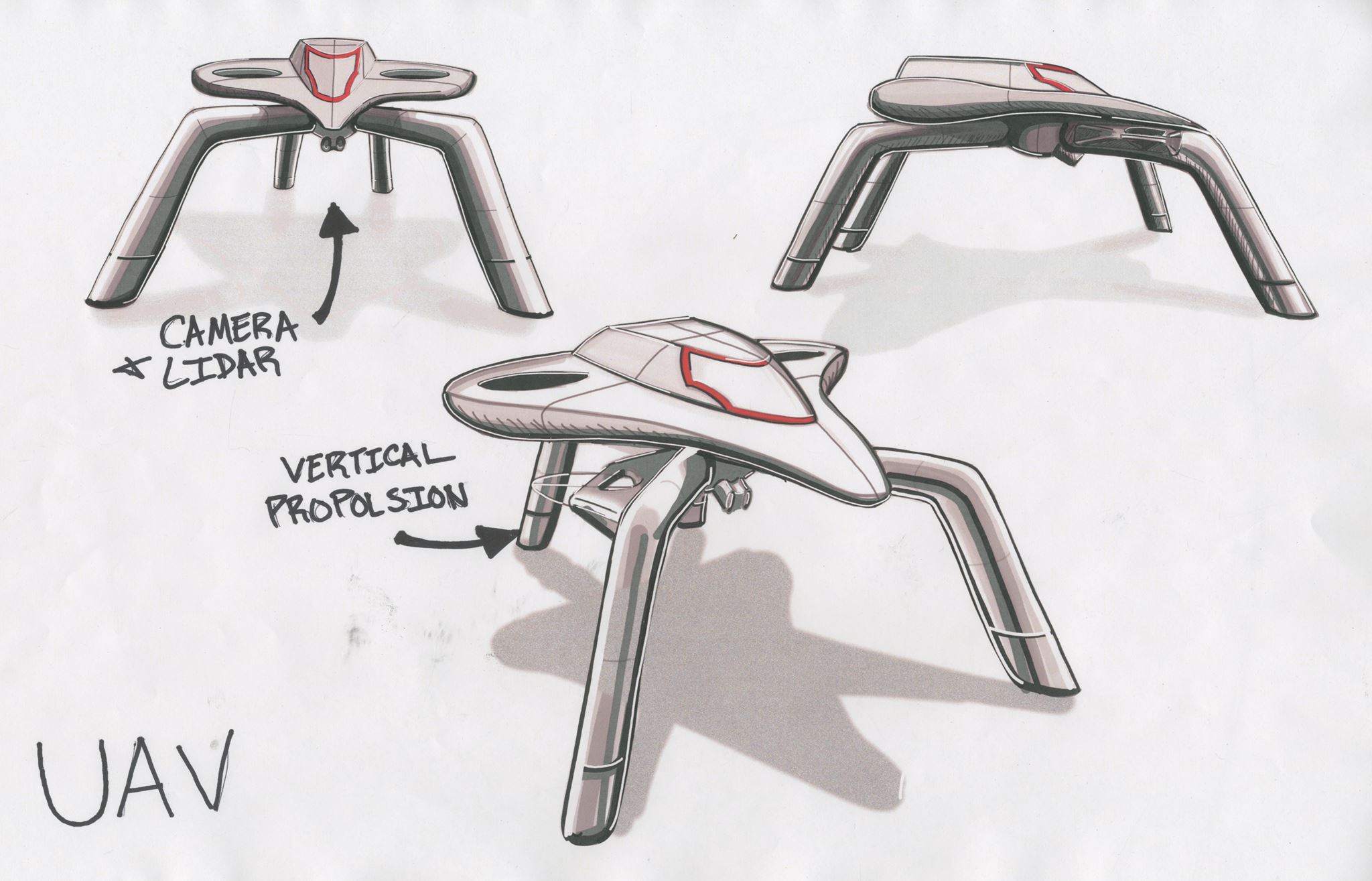
The ideal UAV design created by Savio Duong.
The most high-quality UAV design will also include a LIDAR system, a laser system that maps the area which could ultimately be used to generate maps of the area. This would allow for the images to have a map attached to their area, creating a full-fledged detailed and articulate map.
Although both ideas are large and complex, the team hopes that this two-part system could be an effective plan for restoration efforts moving forward. Team members will be traveling to Florida in the coming days to test out the plausibility of these two drones and their usefulness on oyster restoration.